


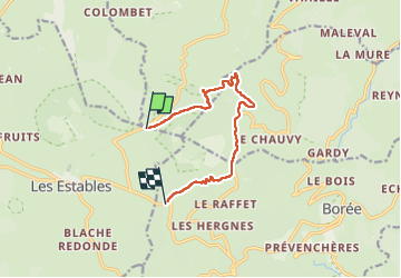
J2 Ascension et Tour du Mont Mezenc

CABERMAT
User

Length
14.1 km

Max alt
1740 m

Uphill gradient
475 m
Km-Effort
20 km

Min alt
1318 m

Downhill gradient
478 m
Boucle
Yes
Creation date :
2025-05-19 11:17:04.04
Updated on :
2025-05-28 14:41:36.669
4h39
Difficulty : Very difficult

FREE GPS app for hiking
 SityTrail
IGN / Geographical institutes
SityTrail Plus
The world is yours!
About
Trail Walking of 14.1 km to be discovered at Auvergne-Rhône-Alpes, Haute-Loire, Les Estables. This trail is proposed by CABERMAT.
Description
départ possible de la croix des Boutières
Positioning
Country:
France
Region :
Auvergne-Rhône-Alpes
Department/Province :
Haute-Loire
Municipality :
Les Estables
Location:
Unknown
Start:(Dec)
Start:(UTM)
593079 ; 4974286 (31T) N.
Comments